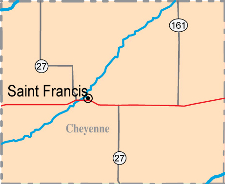
Cheyenne County
County Seat: St. Francis
County Size: 1021 square miles
County Checklist: 242
species
DeLorme pages 15 & 16
Google Map of Cheyenne County
Best Birds: Northern Wheatear, Cassin’s Vireo
Cheyenne County has larger amounts
of riparian habitat and surface water than most of Western Kansas, but it is
still Western Kansas. The 480-acre St. Francis Wildlife Area is the only sizable
area of public land. The South Fork Republican River enters from Colorado near
the southwest corner of the county and exits into Nebraska near the northeast
corner of the county. It dominates the county’s geography. The northwest part of
the county is known for the Arikaree Breaks. The Arikaree River cuts across the
very northwest tip of the county. This “river” is generally dry, but there are
scattered cottonwood stands and one low-water crossing. Cherry and Plum Creeks
are intermittent streams also located in this quadrant. Most of the south part
of the county from St. Francis south and east is farmland. The southwest portion
of the county still has some remaining sand-sage prairie as well as large areas
of farmland. I am not aware of any permanent standing water south of the
Republican River Valley. Whenever you visit, be sure to watch and listen for
western species such as Western Tanager and Western Wood-Pewee. Also, remember
that many species that are common in the rest of Kansas are good finds out here.
1. Republican River Crossings - The south fork of the Republican River
bisects the county from southwest to northeast. The entire length of this valley
contains cottonwoods dating from the 1936 flood. Willows and non-native species
have increased in recent years. Junipers are also beginning to invade. The river
generally has some year-round flow, but irrigation from the Ogallala Aquifer has
reduced the flow and drained most of the marshes that formerly dotted the river
valley. The River Road generally parallels the river. West of St. Francis, it is
on the south side of the river and eventually becomes County Road 1. East of
town, it is on the north side of the river and becomes Rd AA. Seven county road
bridges cross the river in Cheyenne County. All are on private land, but they do
provide some birding from the road access. The County Road 3 crossing two miles
from the Colorado state line often provides the best road birding opportunity.
Trees and wetlands border the road on both sides for three-quarters of a mile
here. County Road G, west from Road 2, also provides great riparian access near
the state line, though it does not cross the river. Near where the river exits
into Nebraska, Road DD passes through a nice section of riparian timber as well.
DeLorme: 15, G1, G2, G3, G3, D3, D4, and C5
2. St. Francis River Walk - The St. Francis River Walk is located on
private property along the Republican River. The south end is located at the
northwest edge of St. Francis. Directions: To access the River Walk, drive north
on River Street (west end of St. Francis). After you pass the grain elevators,
the street turns west and crosses the river. Right on the corner, look for a
driveway on the right going down to a small parking lot. The River Walk begins
here and goes north for about ¾ of a mile along the east side of the river. DO
NOT CROSS THE FENCE ONTO THE CLOSED PRIVATE PROPERTY AT THE END OF THIS SECTION
OF THE WALK.
Delorme: 15, F3
3. St. Francis Keller Lake - This small (3 acre) lake sometimes holds
waterfowl. There are also small marshy areas on the area around the lake. This
lake is kept full by ground water, so always holds water. Cover on the property
can be good for sparrows and migrants. Directions: Keller Lake is on the north
side of River Street immediately after it crosses the river. GPS Location: N39
46 49.28 W101 48 36.77.
4. Arikaree Breaks -
The Arikaree Breaks were a finalist in the eight Wonders of Kansas voting. The
birding here may not be spectacular, but a visit to Cheyenne County is not
complete until you have seen “the breaks.” Golden Eagles have often nested on
private land in this area. Watch and listen for prairie birds at the various
stops. The intermittent flow of the Arikaree River cuts across the extreme
northwest corner of the county. One public road crosses this river on private
land. This same road leads to the three corners where Kansas, Colorado and
Nebraska come together. Directions: (Mostly quoted from the naturalkansas.org
web site): Go 2 miles west of St. Francis to the intersection of K-27. Travel
north 17.5 miles on K-27 to an intersection that is 4 miles south of the
Nebraska border and 1.2 miles north of the Williams Natural Gas pump station.
From this intersection go 2 miles west and turn north. A 16-mile loop drive
begins from this intersection. Travel north 1.2 miles to the prairie dog town
(which is on private property, so view it from the road). Continue north,
turning left at every road intersection. The most scenic breaks are about 2.5
miles past the Arikaree River valley.
Delorme: 15, C1-D2
5. St. Francis Wildlife Area - This area is 480 acres designated for
public hunting and fishing. It is located about three miles southwest of St.
Francis and is bisected by the Republican River. The terrain varies from
sand-sage to riparian. Several ponds are accessible on the south side of the
river. Wet years produce some marsh areas as well. More wooded areas tend to be
north of the river. Directions: From St. Francis, drive west on highway 36 and
take the first left which is the River Road. Follow this road southwest three
miles to the St. Francis wildlife Area, which is located on the north side of
the road. Access the St. Francis Wildlife Area from the River Road at Road 11 or
from the north by Road 10 from US-36.
DeLorme: 15, F2
6. St. Francis Sewer Ponds - The St. Francis sewer ponds can be viewed at
a distance from the cemetery road. They are located about a mile northeast of
town, just east of the fairgrounds. The area between the fairgrounds and the
sewer ponds is a relatively reliable location for Black-billed Magpie.
Directions: Take College Street north to North Street. Turn east on North
Street, and scope the sewer ponds from the road near the cemetery.
DeLorme: 15, F3
7. Playas - If the rains come big enough and at the right time of the
year, there is some great playa birding in Cheyenne County. The area from
Wheeler to Bird City has a number of playas near highways 27 and 36. Even with
rains, the potential of playas varies greatly depending on crop rotations and
farming practices. Road O north of highway 36 between Wheeler and Bird City has
some good playas. Some of the best playas have been along highway 27 in the
first three miles south of Wheeler. In general, most Cheyenne County playas are
south of highway 36 and south of the river. Check the DeLorme Atlas, but many
playas are not shown. Use this link to see a good map of
Cheyenne County playas.
DeLorme: 15, F3-H5
8. St. Francis and Bird City - Both towns provide some birding
opportunities. Both towns have some mature trees and other habitat opportunities
associated with human intervention. St. Francis hosts active Purple Martin
colonies, particularly in the northeast part of town.
Updated November 2012 - HA